
Difficulty
easy

Distance
5 miles round trip
Seasonal Availability:
Spring, Summer, Fall. Trail closed in winter.
Uses: Hike, bike.
Parking: No parking lot or trailhead, access via adjacent neighborhoods or Ophir School.
Dogs: leash dogs or keep dogs under voice and sight command (trail is adjacent to a busy highway; leashes are recommended)
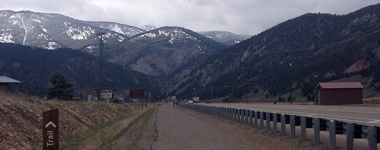
A paved trail between Big Sky Conoco and Ophir school that connects to the Lone Peak Trail and Town Center.
Gallatin trail is an 8-foot wide, paved path which parallels Highway 191 from the corner with Lone Mountain Trail (Hwy 64) for 2.5 miles to end at the Ophir School while along the way providing connections to Buck’s T4 Lodge, a historic dining location. Take a 100ft detour on Michener Creek Road to access the Mud Creek trailhead, which provides 3 miles of hiking and biking.
The trail is nearly flat for its entire length and provides excellent view east into the Porcupine Creek drainage, a US Fish and wildlife refuge and favorite wintering grounds for the northern Yellowstone elk herds, located on the opposite side of the highway and the Gallatin River.
Gallatin trail is not maintained for winter use.
Trailforks:
More Trails:
Black Diamond
Crail Ranch
Gallatin Canyon
Hummocks
Kircher
Little Willow Way
Lone Peak
Mountain to Meadow
Mud Creek Trail
Ousel Falls
Ralph's Pass
South Fork Loop
Tanner's Way
Uplands
Huff's Trek
Coldsmoke Out & Back
Get Involved
More Ways to Give
Support a campaign, donate stock or explore naming & sponsorship opportunities.