BSCO public trails
Mud Creek TrailThis trail is available for sponsorship! Learn more here.

Difficulty
moderate
(biking: climb is easy,
descent is moderate)

Distance
3 miles round trip
Year Round Access:
Trail is ungroomed and can be icy in the winter. Snowshoes or traction gear recommended.
Uses: Hike, Bike, Snowshoe, Fat Bike.
Parking: Parking lot located on south side of Michener Creek Rd, just off Hwy 191.
Dogs: leash dogs or keep dogs under voice and sight command.
Amenities: Trailhead informational kiosk, dog waste station.
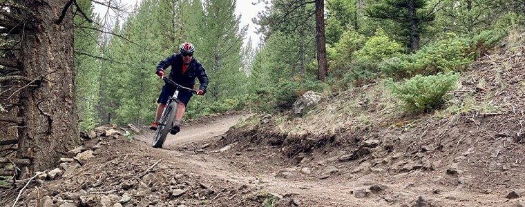
The 3-mile Mud Creek Trail Loop offers a beginner-friendly mountain biking route located about a mile south of Big Sky off of U.S. Highway 191.
The Michener Creek Trails quickly gained traction and popularity since being built by Terraflow Trail Systems in 2019 through private funders. The trails came under the Big Sky Community Organization trail system in May of 2021 thanks to the help of the Blackfoot Hills Property Owners Association and at that point the trails reverted to their historical name of Mud Creek.
The Mud Creek Trail loop is 3 miles in length and climbs about 450 feet in the first 1.5 miles, providing an opportunity to get your blood pumping a bit before the fast and flowy descent with berms and terrain features to enhance the ride. The trail should be ridden counter-clockwise and features a beginner-friendly climb and the descent is in the intermediate range.
For those beginners that are nervous about the descent they can return the way they came up on the climbing trail. Hikers are welcome on the climbing trail but should steer clear of hiking on the descending trail for everyone’s safety. There is signage at the 1.5-mile mark to indicate where the trail changes from two-way traffic to recommended downhill use only.
The Mud Creek Trails are easy to access. From Big Sky travel about a mile south on U.S. Highway 191 and turn at the Michener Creek Road located between The Whitewater Inn and Canyon Adventures. Or, leave your car at home and bike the paved Lone Mountain Trail that runs from Town Center to the Big Sky Conoco. At that point the trail becomes the Gallatin Canyon Trail which keeps you safely off the road the entire time ending at Ophir Elementary School. BSCO added an informational kiosk and trail signage and plans to add a bear-proof trash receptacle for users’ convenience.

Trailforks:
Directions: 0.8 miles south of the stoplight at the intersection of Hwy 191 and Hwy 64 (Lone Mountain Trail), turn west onto Michener Creek Road. Trailhead is located 50 yards up the road from the Hwy.
More Trails:
Black Diamond
Crail Ranch
Gallatin Canyon
Hummocks
Kircher
Little Willow Way
Lone Peak
Mountain to Meadow
Mud Creek Trail
Ousel Falls
Ralph's Pass
South Fork Loop
Tanner's Way
Uplands
Huff's Trek
Coldsmoke Out & Back
BSCO Public Trails
BSCO manages 23+ miles of trails that are all multi-use and multi-directional.
Ralph’s Pass (closed in winter)
Info & Maps:
Multi-Seasonal Use
The majority of BSCO trails are open year-round, barring any temporary seasonal hazard closures.
= Groomed or plowed during the winter.Note: Ungroomed / plowed trails are still open & get packed down by use.
BSCO Projects
We are always looking at opportunities to increase parklands and open spaces while further developing public recreation amenities.
Get Involved
More Ways to Give
Support a campaign, donate stock or explore naming & sponsorship opportunities.
